
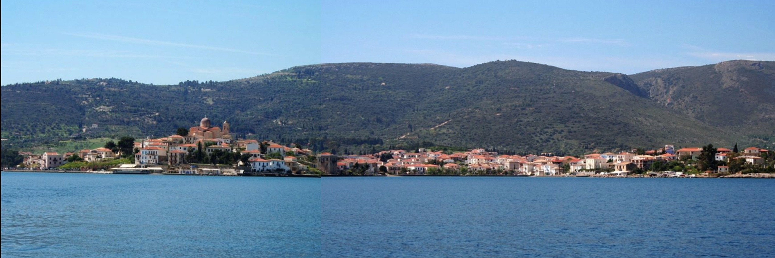
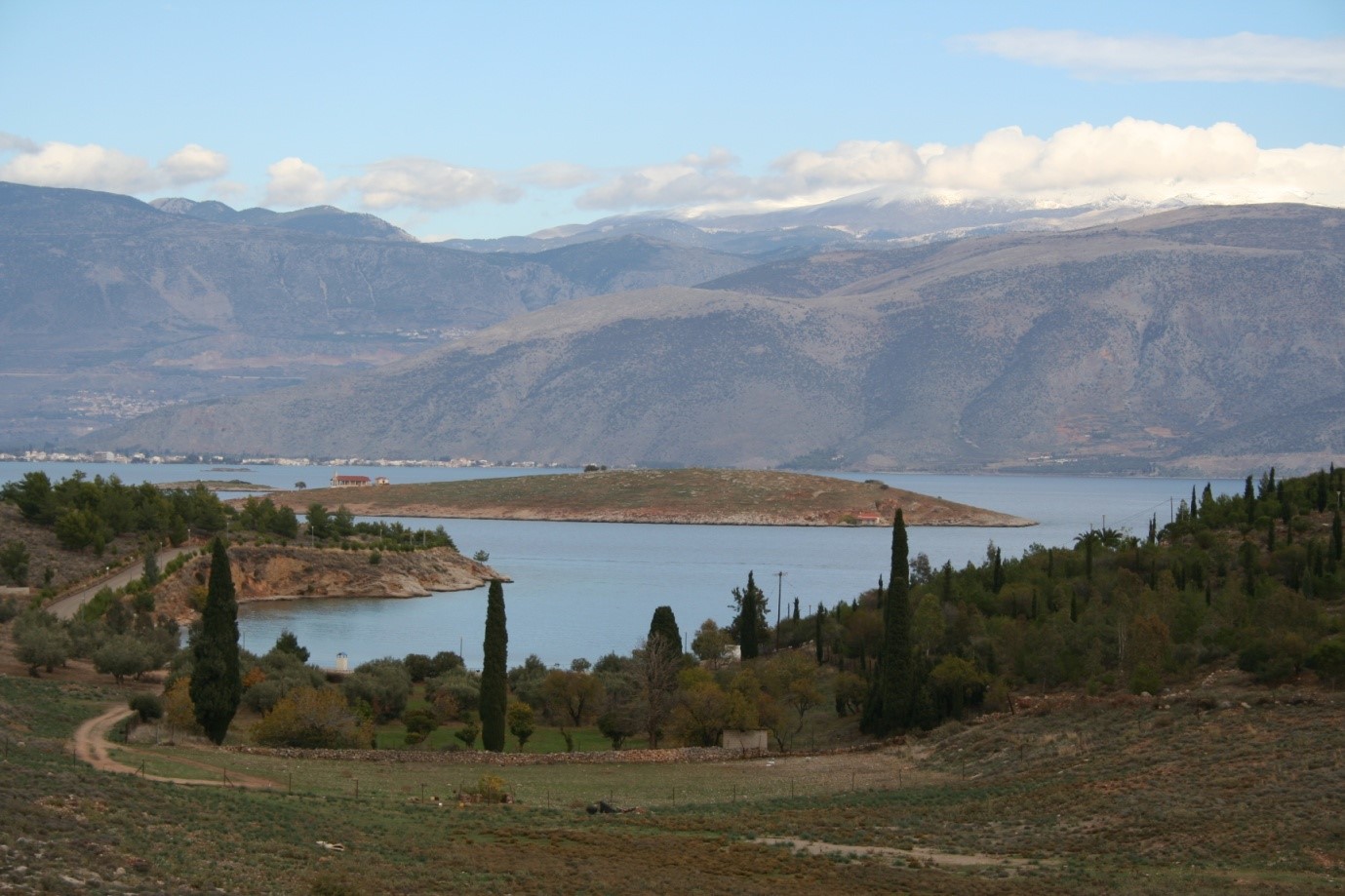
The charm of Galaxidi is not limited to the port and the traditional town, but also to the surrounding hills, slopes, small downhill valleys, beaches and islets. You appreciate the landscape better as you approach Galaxidi from the sea. As you sail nearer you get a beautiful view. The expanse of the sea is interrupted by small islands and end up at the coastal settlement between two coves Limani or Agora and Hirolaka..
You get the view of the pink roofs of the houses and at the top of the elevated district which is dominated by Agios Nikolaos church. The background is formed by a charming polymorphic ridge that descends to steep slopes and calm down ending downhill in green coastal narrow plains. Depending on the season, the hills take on a different shade, while the morning light in particular creates shadows that emphasize an exquisite relief.
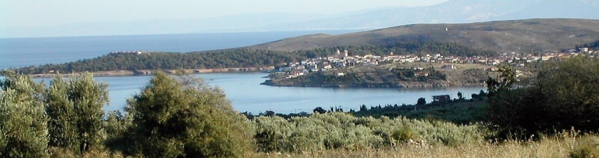
The coast of the bay of Galaxidi from south to north with the ridge in the background that accentuates an exquisite relief.
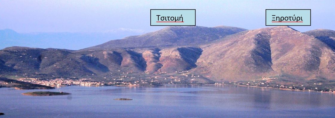
Towards the north, can be seen the imposing pyramid of Prophet Elias Elias (or Papalia in the local pastoral dialect). It is located between the villages of Vounihora and Pentaoria, whch are not visible from Galaxidi. Immediately to the south and lower towards the sea, the large pyramid of Xirotiri hill and then three lower hills: Tsoukos (at its foot is the Agios Nikolaos Foundation), the Castle hill and then the Trapeza hill with the cave Mageras.A deep ravine, between the last two hills brings down pebbles and large gravel that fill a large part of the small valley Keramou.South of the Trapeza rises the Agios Athanasios hill, crowned by a circular ancient fortification. ( See: Baxiotopoulou E., Valavanis P., Two Ancient Citadels in the Galaxidi Mountains, Fokika Chronika 4,1992,157.) This hill continues up to Kefalari , and in a shallow saddle is the Monastery of Christ the Saviour.Kefalari slopes steeply towards the sea of the Corinthian Gulf and ends at the beach of Agios Vasilios.
In the background, behind Xirotiri hill is Karvelas, Karvelas, now with wind turbines on top, and Paliopournara while still further south rises Tsitomi, also with wind turbines, which falls steeply to the west forming the banks of Kalamorema, which starts from Pentaoria village and ends at Vidavi seaside. To the north, the dark hills of Southern Giona can be seen.
In the saddle between the foothills of the Prophet Elias hill called Balaera and the Xirolimni hill, hill, where the road to Vounihora meets the road to Pendaoria, ends the low-altitude rise of Elafokarto or Alafokarto, where you find ruins of an ancient acropolis. Elafokarto has steep vertical slopes east and west but a smooth descent towards the olive grove to the south. Its north projection is Papalakos hill. A deep ravine separates Elafokarto from the flattish Xirolimni hill which is intersected by the shallow Karakofolia ravine.
The largest of the coastal plains is Kampos, the sloping triangular olive grove – now home to many buildings. The olive grove is between the hills of Xirotiri, Prophet Elias and Xirolimni and reaches the sea. This plain to the south is defined by the estuary of Koniarema, which starts from Pentaoria and goes through Kleftopanagia, while to the east the National Road passes along the coast where the church of Prophet Elias, Ailias, is located. Almost in the centre of the plain you meet a sinkhole called Kato Dropos. To the north, a gravel stream is Dragasia .
If you walk these hills, in addition to the beautiful, low vegetation with a variety of flowers in the spring you find dense traces of human activity. Everywhere ruins of old paths and mule tracks, retaining walls, clearings worked with a hoe, corrals, dry stones and foundations of stone huts.
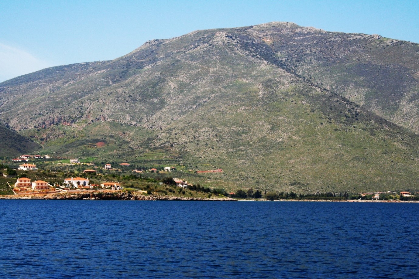
The Xirotiri hill dominates the Galaxidi Plain. Near the top is the Angona cave
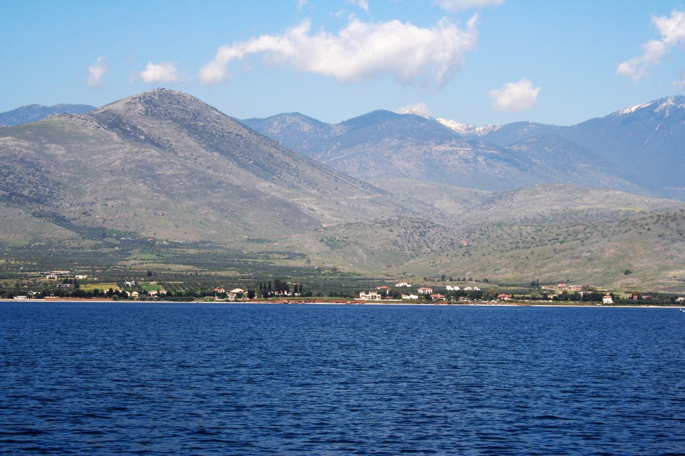
To the left of the picture, the hill of Prophet Elias, to the right and seaside Xirolimni, between them Elafokartos and behind the smooth hill of Papalakos. In the background the hills of southern Giona
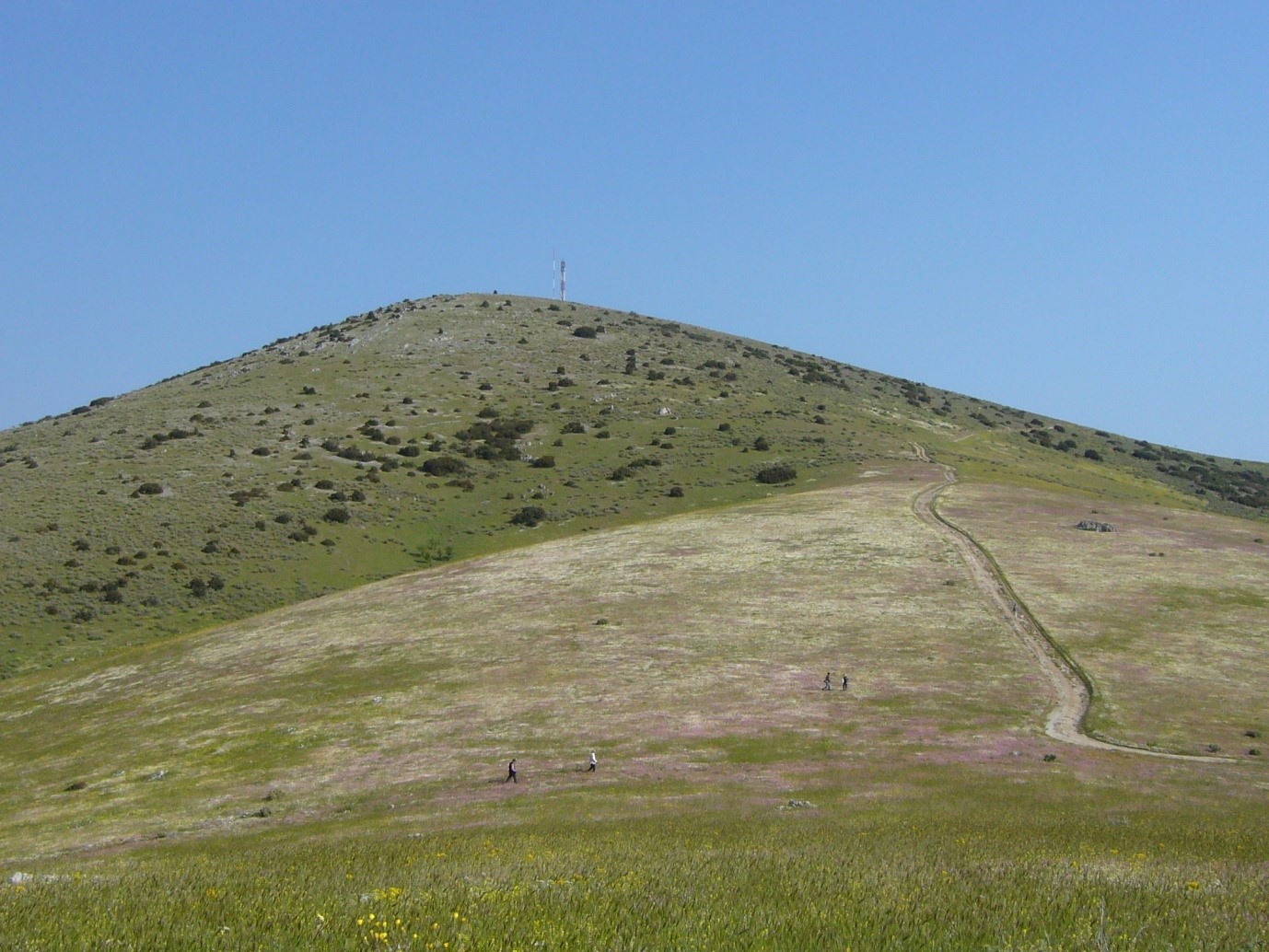
The top of Prophet Elias hill in the spring
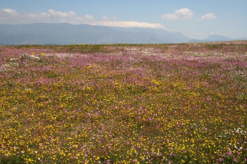
A carpet of wildflowers on the slopes of Prophet Elias
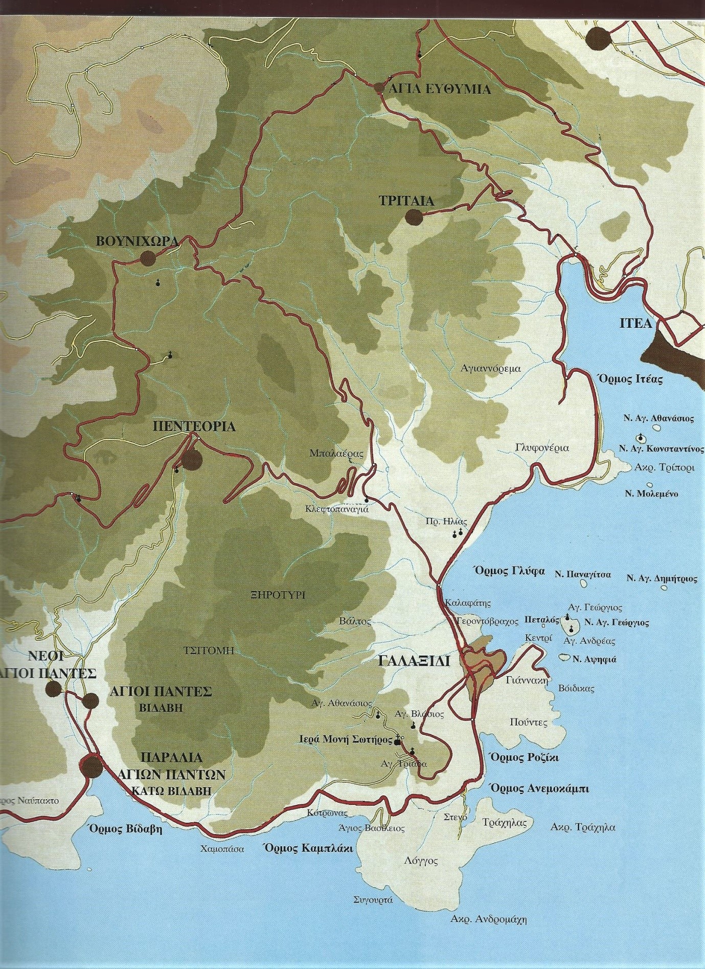
The seaside locations of the western side of Krissaic gulf , where Galaxidi is located, start from Cape Andromachi Cape Andromachi which marks the entrance of the gulf. This is where the Longos hill ends and continues with the Trachilas promontory, at the top of which dominates the Church and the building of the association "Panagia Galaxa Thalassokratousa". Trachilas surrounds Anemokambi bay. This cove has two narrow inlets, one to the south, the Steno cove, and one to the north, the Roziki cove. The elevation behind Anemokambi is Goumarnas. To the north of Anemokambi bay is the hill of Giannakis , where the facilities of the sewage processing are located. A shallow gully and creek separates Giannaki from the small headland Kentri , and from Kentri begins Pera-panta with the pine wood that faces the main harbour, the Agora. To the north side of the old town stretches the Hirolakas bay. It is protected from the north by a sea wall next to Karnagio , and on the other side is the Vistrithra cove . The coast then becomes rocky and somewhere there projects Skeletovrachos rock . Above the rocky beach the smooth hill is the Mesorachi or Mylos , where there was a windmill, now has completely disappeared. Mesorachi descends to Kalafati or Glyfa bay and from there the beach becomes smooth until the large cape Tripori with interesting vegetation and shores and two sinkholes inside.
Thus the bay of Galaxidi is defined by Cape Kendri to the south and Cape Tripori to the north.
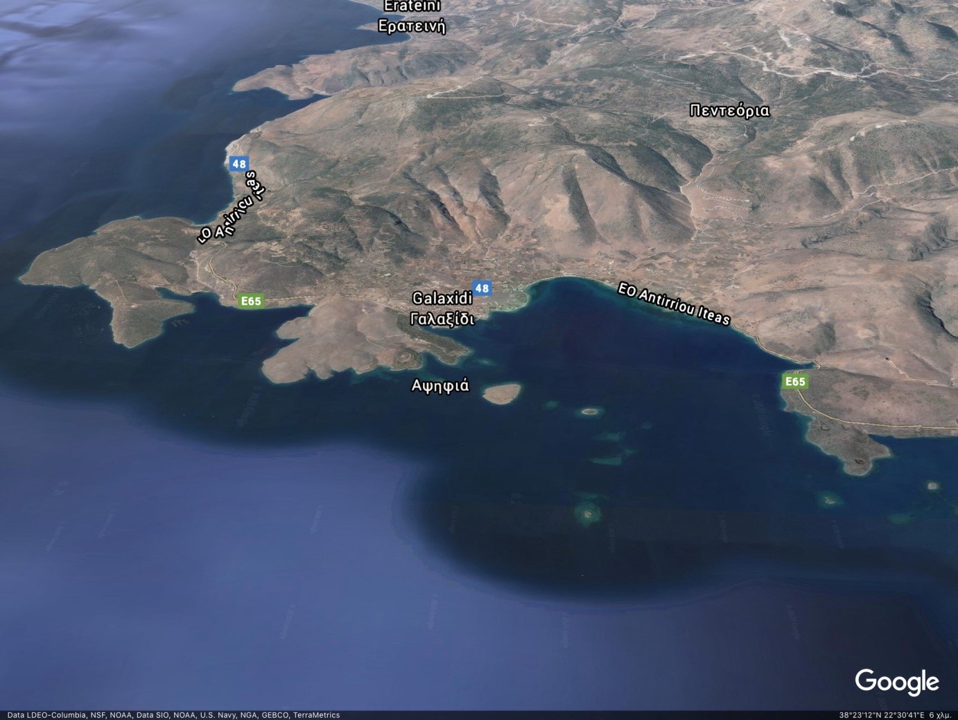
From Cape Andromachi on the left edge to Tripori on the right. (Google Maps).
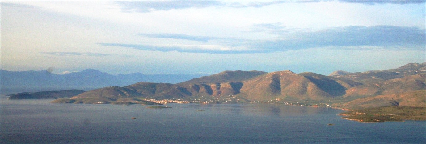
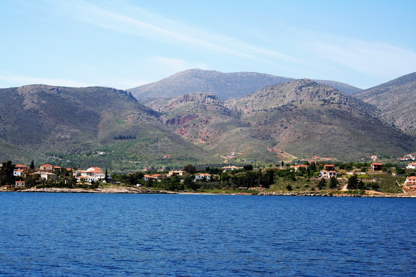
The western coast of the Krissaic Gulf with Galaxidi in the middle.
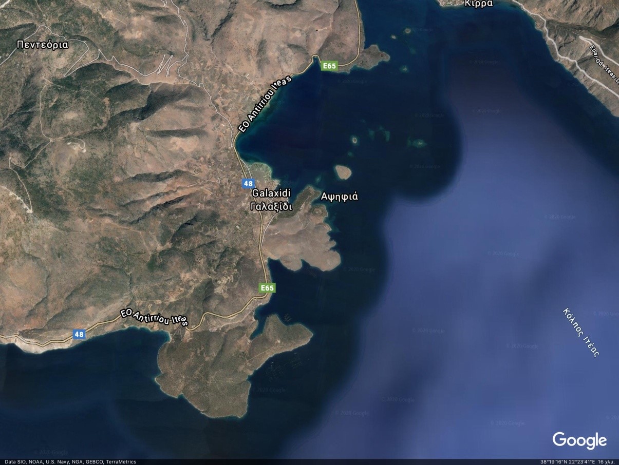
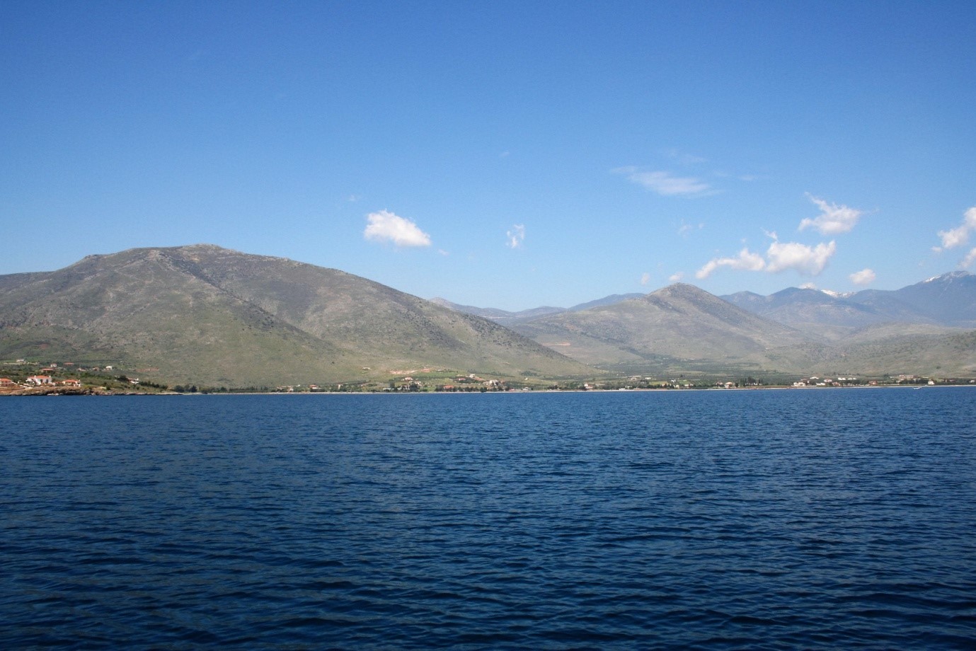
The west coast with the bays of Galaxidi and Anemokambi
Giannaki cove with St. George in the background
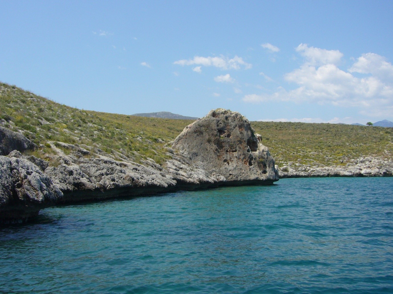
The rock of Maimus, a popular jumping-off point for diving
This interesting and beautiful topography needs love and protection and the concern not to forget the toponyms.
The Paths in the countryside of Galaxidi. In the footsteps of the ancestors.
To leave today the car and the urban life and experience activities in nature as did our ancestors for thousands of years is a rebirth in the mother nature, the past and in history.
On Saturday, May 29, 2021, at the urging of the president of the community Mr. Spyros Barliakos, we climbed the path that leads from Galaxidi to Agios Vlasis. Up to the Loutzina fountain the old path had recently been widened with graders, resulting in easier climbing. From the Loutzina fountain upwards things were difficult, because in several places the ground was steeply and uphill, the original path narrowed and the grass had drowned and made climb difficult. However there and specially in the places where the old paving was preserved, the experience was intense with primeval feelings. At times, when the ancient stones of Chaleion spring above the bushes next to the dried fountain under the church you sense the past. When you look further away, the different views near and far, the sea and the settlement seen from various angles and altitudes are extremely interesting.
Our goal is the revival of the roots of old Galaxidians visiting the Chapels in the area during festivities as pilgrimage like in the eve of St. Vlasios day (February 11),the Holy Trinity day(the Monday of the Holy Spirit, this year June 21), and the Transfiguration of the Savior (August 6). A procession led by the priest and followed by all of us. Upon reaching the top will recite evening prayers , which can be followed by the reading of relevant texts, e.g. short stories by Papadiamantis and close with a simple treat to all participants, so that our bodies tired from the arduous ascent, will rejoice.
In these simple ways practiced for thousands of years by our ancestors, the spirit and soul come at peace and the sense of common religious and cultural identity is revived. Of course, all these activities can be done individually or in groups, which depending on the season, will find anemones, wild orchids, dandelions, photography, archaeological interests, mountain running or all these together.
These walks can encourage the restoration of trails around Galaxidi. What needs to be done by municipal authorities and local cultural societies is to take care of these every year, so that they remain open and accessible. And perhaps, if possible, to repair or even restore the paving in the places where it is damaged. And if this succeeds, a more systematic research can follow, with recording and mapping, sign posted , marking of points of particular interest, such threshing floors, wine presses, wells and monuments.
Thus, locals and foreigners will always be given the opportunity for mild physical exercise and activity, for direct contact with nature, for better acquaintance with the place, as well as for honoring the memory of all the older people who lived here, and with the struggle for survival and the sweat they poured, they helped in the continuation of life in this small and beautiful place.
Panos Valavanis, Kostas Zervas, Giorgos Soumas